
Abgeschlossene Dissertationen 2010 - bis jetzt
Gustav Hanke

Birgit Kain-Bückner
Introduction
The mineralogy of iron ore carriers is one of the key tools for understanding the reduction behavior. By analyzing images from polished sections it is possible to get parameters like mode and porosity in a short period of time compared to point counting. For the evaluation of iron ore carriers different limiting factors are identified and algorithms are developed to predict the quality of the charge material.
Principle image processing of iron ore carriers
It is necessary to keep the settings for image acquisition constant. The number of images for processing depends on the grain size and the uniformity of the texture and ranges between 200 and 1000 images per grain fraction. The positions of the image acquisition raster’s are randomly distributed and the size of the raster depends on the grain size and texture of the sample too.
In order to respond to the characteristics of the different types of iron ore carriers their evaluation algorithms are realized with the measurement and automation programming language LabVIEW developed by National Instruments. First, before the actual processing routine, the quality control is performed. The quality control comprises of an edge detection program. Every image is executed by a differentiation filter. This filter produces continuous contours by highlighting each pixel where an intensity variation occurs between itself and its neighbors. The mean value of the highlighted pixels for every image is calculated and diagrammed by a boxplot. This display option gives a first impression of the overall image quality. Every image below a defined drop out value is removed. With this algorithm it is possible to eject blurred images and mostly black images (e.g. out of grain/sample boundary). Next step removes color fringes between dark and bright areas by correction of the color layers. Image noise is minimized by a suitable filter routine like Gaussian filter. The evaluation routine starts with phase identification by thresholding. Each phase gets unique intervals for RGB (red, green and blue) and HSL (hue, saturation and luminescence). Depending on the texture of the ore and effects like interior reflections it is necessary to correct the phase identification with morphology tools like erode/dilate or removing small particles.
Evaluation
Hematite, magnetite and limonite are identified on considering lump ores. For pellets hematite and magnetite are combined to Fe oxide. In addition glass and pores are identified. The identified area to image area is accumulated image by image. Referring to the basic equation from stereology VV=AA based on the principle of Cavalieri the percentage of volume is calculated for each phase.
The quality evaluation of lump ore is based on a simulation of the reduction process by a concentric phase front movement. It is a distance contouring by encoding a pixel value of a particle as a function of the location of that pixel in relation to the distance to the border of the particle. As a result every particle is subdivided into concentric shells from border to core. The algorithm is called Danielsson distance map by Erik Danielsson.
Depending on the reducibility of each phase an assured number of shells is excluded from one calculation step to the next, starting at the border of the phases. The remaining area is measured. This simulates the progress of the reduction front in a certain period of time which is distinctive for every mineral phase. For each of these calculation steps the removed area is displayed as diagram (amount of steps/ cum. removed area). The results correlate with the reduction progress (time/ reduction grade) as measured with standard reduction tests for the same samples performed at the Department of Metallurgy.
The pellet evaluation is based on a pore size distribution model. The pore area is measured and the diameter of a coextensive circle is calculated. The result is displayed as a cumulative distribution diagram (equivalent diameter/ relative frequency). Compared to the reduction curves from standard reduction tests the performance of pellet samples is assumed to be positively influenced by a high amount of large pores.
Peter Onuk
In the beginning of the 1990ies, both the long-lasting experience and tradition of Austrian companies in base metal mining from domestic sources was terminated by the closure of the zinc-lead mine at Bleiberg-Kreuth. Zinc, copper, lead and silver were the major commodities mined in base metal deposits within Austria; time was not ripe for the extraction of high-technology metals (germanium, gallium, indium, cobalt), most of which are on the list of critical raw materials nowadays, and the world demand was low. It was only in the smelter located at Arnoldstein that trace metals such as cadmium and germanium had been recovered in the 1980ies as by-products of zinc and lead ores from Bleiberg. Trace metals usually do not form discrete minerals that are susceptible to pre-concentration methods, but are frequently substituted into the lattices of common zinc-copper-lead sulphides (such as sphalerite, galena, chalcopyrite, pyrite) and fahlores, complex copper-arsenic-antimony sulphide minerals. In this case, the trace elements can only be liberated by hydro- or pyro-metallurgical methods. Only small amounts may be present as discrete minerals such as cobalt arsenide or cobalt sulpharsenide. Generally, complex and fine intergrowth textures require the use of complex processing methods that need to be developed based on a sound knowledge of process mineralogical parameters such as grain size, liberation and associated minerals.
Austria is known as a “country rich in poor ore deposits” (Friedrich, 1953). However, there are numerous occurrences of ore deposits that are potentially enriched in high-technology metals. Starting in the 1950ies, the late Erich Schroll was the first to analyse trace metals in ores. However, investigations on the concentration and especially on the mineralogical siting of trace metals in ores have been carried out in a limited manner only; modern, systematic research using state-of-the-art analytical methods is almost completely missing. Such methods have only recently been used to analyse ore samples from Bleiberg and a few surrounding deposits (Henjes-Kunst, 2014).
The Austrian Mineral Resources Plan, developed by the former Federal Ministry for Economy, Family and Youth (now Federal Ministry of Science, Research and Economy, bmwfw) and edited by the Geologische Bundesanstalt (Weber, 2012) has identified former mining areas that, based on the data available, deserve to be protected and secured for future generations. Five areas potentially endowed with critical metals will be selected from a list of protectable base metal deposits and investigated in this project. This includes (1) systematic research of literature and archives, (2) a search for sample material available in mineral and ore collections, (3) geological mapping, (4) sampling of accessible mines and waste dumps, as well as (5) analyses of the critical elements using modern analytical methods (XRF, EPMA, MLA, LA-ICP-MS). The major goals are to investigate the mineralogical and chemical siting of critical high-technology metals in the ores using high spatial resolution techniques, to analyse their distribution, and to calculate possible resources. The results will provide specific parameters for mineral processing, including a process-mineralogical characterization of the ores.


Andy Yahya Al Hakim
Introduction
The magmatic arc system in Indonesia is the result of a complex history of tectonic events, including the plate subduction and the arc magmatism. Many potentials ore deposits has not been studied and observed well, that become more interesting to elaborate deeper by the researcher in the future. Unknown information about characteristics of ore deposits might be result in the problems of environment, such as problems in acid mine drainage and also the contamination of heavy mineral.
Awak Mas is located in a mountainous area in the Luwu Regency of South Sulawesi Province, Indonesia. The drilling in Awak Mas area is done since early 1990 until 2012, and resulted in 3 main prospects, Awak Mas, Sallu Bullo and Great Tarra. Mineralization at Awak Mas is associated with quartz veining, brecciation, and silicification within foliated meta-sediments and within fault zones. Albite-silica-pyrite ± carbonate alteration generally accompanies and envelopes quartz-bearing rocks. Gold mineralization is associated with fine grained pyrite within alteration zones. Two main styles of mineralization are evident including that within: 1) steeply dipping, structurally controlled quartz veins and stockworks with attendant brecciation and silica flooding, and 2) foliation parallel zones of quartz veins and stockworks. Some zones of quartz enrichment are barren of mineralization. The steeply dipping zones likely developed along pre-mineral faults that served as conduits to hydrothermal fluids from which gold precipitated. The second style formed in an upper level, nearer surface environment where hydrothermal fluids migrated laterally into permeable beds or foliated (bedding parallel) zones under decreased lithostatic confining pressures.
The basic study in ore deposits, such as the study of ore deposits genesis and mineral, characteristics of ore mineralization, geochemical study, micro thermometry that correlate with the characteristics of fluids, are tends to be the interested to be studied to reveal the characteristics in many epithermal deposits in Indonesia, related with environmental aspects.
The mineral paragenesis, formation condition, alteration group minerals, gangue and ore minerals observed, are used not only for the purpose of ore deposition and the characteristics of minerals, that gives us information about the past and the forming of deposits; but also gives us information about the environmental study, that occur as a product of geological and mining activity, in correlations with the mineralogy. The important role of minerals in mining environmental problems makes today a very exciting time for mineralogy.
Aims
Basically, the research study will examine exploration and mining development data, with the aims:
(1) to understand the mineralogical aspects that formed in gold deposits with the type of epithermal low sulphidation, in Awak Mas, Sallu Bullo Deposits, South Celebes, based on analytical study, mineralogical study, qualitative and quantitative study with several experimental study using SEM-EDS method, element mapping, age dating, and fluid inclusion analysis;
(2) to identify the ore formation condition in prospect area and determine the period of mineralization in Awak Mas Deposits, South Celebes;
(3) to characterize the alteration and mineralization in several prospect in the area of study;
(4) determine the presence of mineral in the area of research.
The scope of this dissertation entails a detailed investigations of the geology, mineralogy, geochemistry, of epithermal low sulphidation deposits, in South Celebes, Indonesia. The ultimate goal is to construct a model that will describe the genetic of deposit, and the implications to the environment. Based on the results of this investigations, recommendations will be made on where to focus attention in attempts to predict and define additional ore shoots
Anke Wölfler
Talk ist ein wichtiges Industriemineral und findet Verwendung u.a. in der Farben- und Lackindustrie, Kunstoffindustrie und Lebensmittelindustrie. Talkvorkommen sind in der Regel an silikatreiche Dolomite oder Magnesite oder aber auch Ultrabasite gebunden und werden mit tektonischen Ereignissen in Zusammenhang gestellt.
In dieser Arbeit geht es darum die Herkunft und Art der Fluide zu untersuchen, die zur Genese der Talkmineralisation geführt haben. Als Beispiele wurden dazu die Lagerstätten Sa Matta und Su Venosu (Sardinien), Gemerska Poloma (Slowakei) sowie die Magensit- und Talklagerstätten der östlichen Grauwackenzone (Veitsch, Wald am Schober, Lassing) herangezogen.
Neben Geländearbeit und strukturgeologischen Aufnahmen werden weiter Untersuchungen mittels Kohlenstoff- und Sauerstoffisotope an Karbonaten und assoziierten Silikaten durchgeführt, sowie geochemische Analysen (Haupt- und Spurenelemente und SEE). Mikrothermometrie und Crush-Leach-Analysen an Flüssigkeitseinschlüsse sollen die Arbeit abrunden. Mit Hilfe von (U-Th)/He- und Ar/Ar-Datierungen soll der Versuch unternommen werden das Hydrothermalereignis, welches zur Ausfällung der Talks führte, zeitlich einzugrenzen.
Klaus Lassnig
Potential bei Zukunftsprojekten Österreichs aus Sicht der Geologie
Im Zuge des FFG-Forschungsprojektes Nr.: 820 516 „Recycling von Tunnelausbruchsmaterial“ werden österreichische Gesteine vor dem Hintergrund, dass Tunnelausbruchmaterial nicht Abfall, sondern ein hochwertiges Rohstoffpotential darstellt, im Hinblick auf eine bestmögliche und maximale Verwertung bei optimaler Wirtschaftlichkeit und minimaler Umweltbelastung untersucht.
Die Fülle von zukünftigen Tunnel- und Kraftwerksprojekten in Österreich erlaubt es, wesentliche Gesteinseinheiten dahingehend zu untersuchen und damit einen guten Überblick über ihr Verwertungspotential zu bekommen.
Die Verwertung der verschiedensten Ausbruchsgesteine ist im Wesentlichen abhängig von den Gesteinseigenschaften, von Verunreinigungen durch den Baubetrieb, den Bedarf an Rohstoffen im Nahbereich der Tunnelprojekte sowie der Wirtschaftlichkeit der Transportwege.
Ein wesentlicher Faktor für ein zu erstellendes Materialbewirtschaftungskonzept ist der Selektionsprozess beim Tunnelausbruch. Der Ingenieurgeologe muss direkt vor Ort bestimmen, ob das jeweils anstehende Gebirge verwertet werden kann oder deponiert werden muss. Im Rahmen des Projektes sollen daher für potentiell anfallende Ausbruchsmaterialien Verwendungsmöglichkeiten definiert und dafür maßgebliche Gesteinsparameter erkannt und Methoden zu ihrer Schnellbeurteilung vor Ort entwickelt werden. Die Erstellung eines Schnellprüflabors auf der Baustelle ist dabei ein wichtiger Punkt.
Lockere und gering verfestigte Sedimente können neben ihrer Verwertung als Gesteinskörnung, in der Ziegel- und Zementindustrie sowie für keramische Zwecke verwendet werden.
Bei Karbonatgesteinen steht die Verwendung als Gesteinskörnung, Zementrohstoff und als Hüttenzuschlag im Vordergrund. Daneben gibt es aber noch Spezialverwendungen (Flussmittel, Füllstoffe, Futtermittelindustrie, etc.) die vom Chemismus und den optischen Parametern anhängig sind.
Die Verwendung von Kristallingesteinen als Gesteinskörnung für Betone und Mörtel wird von störenden mineralogischen Komponenten (z.B. Glimmer) sowie von ihrer Alkali-Aggregat- Reaktivität limitiert.


Thomas Unterweissacher
Erzlagerstätten mit einer aus Karbonaten und Quarz bestehenden Gangart treten in den Ostalpen relativ häufig auf. Die Bestimmung der Isotopenverhältnisse des Sauerstoffes und des Kohlenstoffes ermöglichen eine Aussage zur Herkunft der lagerstättenbildenden Fluide (meteorisch, magmatisch, metamorphogen oder Mischung verschiedener Wässer) und eine Abschätzung der Bildungstemperatur.
Eine Vorraussetzung um Bildungstemperaturen von Karbonat-Quarz Mineralpaaren zu berechnen ist das Vorhandensein eines isotopischen Gleichgewichts. Ein solches Gleichgewicht stellt einen in der Natur seltenen Idealfall dar. Das Ausmaß des Ungleichgewichtes wird von verschiedenen Faktoren (z.B. metamorphe Überprägung, Fluidalteration) beeinflusst und kann zur Beschreibung dieser Einflussfaktoren eingesetzt werden.
Der Vergleich unterschiedlicher Geothermometer (Kationenaustauschthermometer, Mischkristallreihe FeAsS-CoAsS-NiAsS, Arsenopyritthermometer) an der gesamten Paragenese wird zur Rekonstruktion einer Temperaturgeschichte einzelner Gangbereiche eingesetzt.
Folgende Lagerstätten wurden untersucht: Oberostalpines Kristallin: Zinkwand (Ni-Co-Bi), Tösens (Pb-Zn); Grauwackenzone: Mitterberg & Buchberg (Cu), Radmer (Cu); Penninikum: Erzwies-Silberpfennig (Pb-Ag). Die Teufenerstreckung einzelner Gänge erreicht tlw. über 300 m und umfasst damit eine großen Temperaturbereich.
Die Anwendbarkeit von Isotopengeothermometern ist nur in Kombination anderen Geothermometern und einer soliden Kenntnis regionalgeologischer Einflussfaktoren sinnvoll. Der direkte Vergleich der Sauerstoffisotopie von Karbonaten und Quarz ermöglicht jedoch eine Abschätzung des Ausmaßes von Re-Äquilibrierungsreaktionen während der Abkühlphase bzw. einer möglichen metamorphen Überprägung oder jüngeren Fluidalteration.
Konstantin Horkel
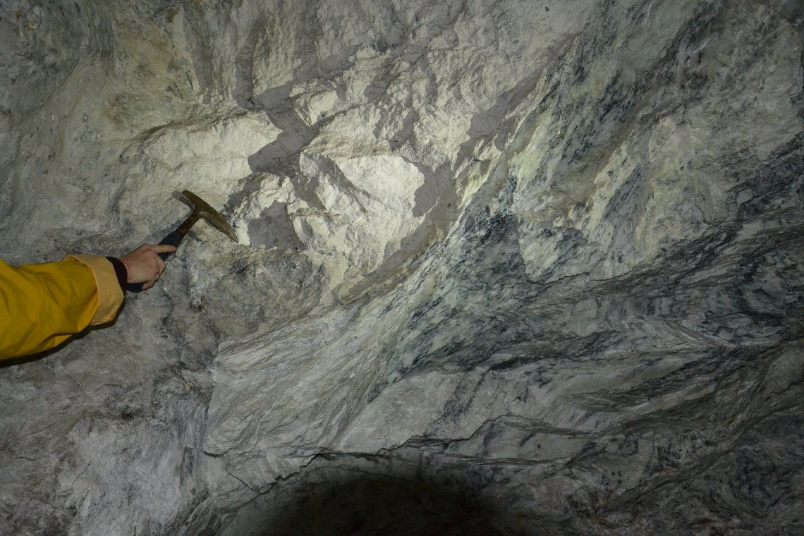
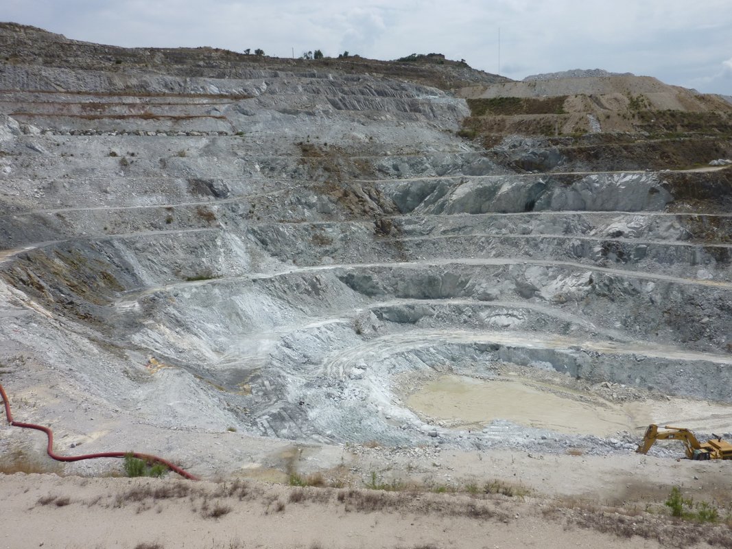
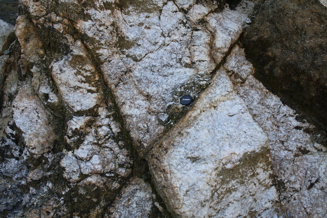
Kryptokristalliner Magnesit (CM) tritt vorwiegend in ultramafischen Gesteinen in tektonisch kontrollierten Gängen und Netzwerken (Karaubath Typ; KT), oder in Sedimenten welche im engen Bezug zu Ultramafiten sind, auf (Bela Stena Typ, BST).
Die repräsentative Magnesitlagerstätte Dutluca/Koçbal beinhaltet Gänge im niedrigsten Bereich des Tagebaus, Netzwerk in oberflächennahen Bereichen, Zebra Netzwerk in stark verwitterten Serpentiniten an der Grenze zum Paläorelief und Magnesitlagen in ultramafischen Konglomeraten und miozänen Sedimenten. CM ist mit Serpentiniten vergesellschaftet und befindet sich in Störungen mit meist gut ausgebildeten Harnischflächen sowie in Klüften welche sich in extensionalen Bereichen (antithetische Riedel Flächen, Klüfte) von prominenten Störungszonen befinden (z.B. Eski?ehir Störungs Zone). Die Störungen sind gewöhnlich steil einfallende, dextrale Seitenverschiebungen mit einhergehenden Abschiebungen. Der Serpentinit erfährt eine Alteration vom Magnesium reichen, dunklen Serpentinit mit Relikten von Olivin und Ortho-Pyroxen zum alterierten Serpentinit mit relativer Anreicherung von Eisen verglichen zu Magnesium. Verwitterter Serpentinit enthält Smektit Minerale, welche die Umwandlungen der Serpentin Minerale sind. Chrom Spinelle deuten darauf, dass sich der Ophiolith in einer Suprasubduktionszone gebildet hat. Alterierter Serpentinit enthält Karbonatkristalle, welche den Olivin und untergeordnet den Bastit, eine Umwandlung des Ortho-Pyroxens, verdrängen. Die Alteration des Serpentinites ist ein wichtiger Hinweis auf Magnesitbildung.
Untersuchungen an Stabilen Isotopen von 14 verschiedenen CM Lagerstätten der Türkei sowie der Typlokalität Kraubath/Österreich haben ergeben, dass zwei verschiedene Systeme der Magnesitbildung vorliegen. Positive ?13CV-PDB Verhältnisse deuten auf oberflächennahe Lagerstätten, die sich im alkalinen Milieu wie etwa Evaporation oder durch biogene Fermentation gebildet haben. Da diese Prozesse an der Oberfläche stattfinden, wird für die Exploration die horizontale Erstreckung wichtig. CM Lagerstätten mit negativen ?13CV-PDB Verhältnissen weisen auf C-Quellen, wie Dekarboxylation von organischem Material oder vulkanischer Entgasung, welche auf die Speisung der Lagerstätte durch aszendente Fluide hindeutet. Negative ?13CV-PDB Verhältnisse werden schwerer je näher das Fluid an die Oberfläche gelangt. Zu einem liegt das an der CO3-2 Entgasung, bei der leichtere Isotope zuerst verdampfen und die schwereren Isotope im Fluid zurückbleiben. Auf der anderen Seite werden aufsteigende Fluide von dem Grundwasser beeinflusst. Folglich haben Magnesitlagen im Sediment stets ein relativ schwereres Isotopenverhältnis als das darunter liegende Netzwerk. Die Geomagnetik nutzt das Phänomen, dass der Serpentinit inhomogen in seiner Suszeptibilität ist. Wenn durch den Serpentinit Störungen gehen, kommt es zu einem abrupten Wechsel in der Suszeptibilität, was eine Anomalie im Erdmagnetfeld verursacht. Dass der Magnesit diamagnetisch ist, hat nur Einfluss, wenn der Magnesitkörper sich direkt an der Oberfläche, nur vom Boden bedeckt, befindet. Petrophysikalische Parameter wie die NRM oder AMS haben ebenfalls Einfluss auf das Erdmagnetfeld. Die Kombination der Daten ermöglicht die Modellierung der geologischen Strukturen im Untergrund. Die Geomagnetik ist eine schnelle und effektive Methode, um vom Boden bedeckte Strukturen zu entdecken und um Magnesit zu erfassen, vorausgesetzt der Körper ist größer als der Messabstand. Paläomagnetik ermöglicht die Eingrenzung tektonischer Blöcke die zueinander rotiert sind und kann somit Hinweise auf Bereiche liefern, die tektonisch beansprucht sind, selbst ohne Anzeichen an der Oberfläche. Nichtsdestotrotz wird die Geomagnetik von der Mächtigkeit der sedimentären Überlagerung beeinträchtigt. Die Mächtigkeit der sedimentären Überlagerung kann mit Hilfe der Geoelektrik untersucht werden.